Day 1. 12/06
Packed and “overloaded” (the slogan of the expedition) we set off from Bicester before the sun rises above the horizon. We have 2 days to reach Hirtshals in Denmark, where a ferry to legendary Iceland, The Land of Fire and Ice, awaits us. Unfortunately, there is no connection between the United Kingdom and Denmark (not to mention the Faroe Islands). It would make it easier for us to move to the final destination, but we must overcome a similar distance to the rest of the team from Krakow. It would seem that from England to Denmark is so close. Our route to Hirtshals goes through England, France, Belgium, Holland, the longest section – Germany and the entire length of Denmark, where we will meet other motorcyclists: Wojtek with Ewa, and Dominik with Ewelina (called also as the Lelons).
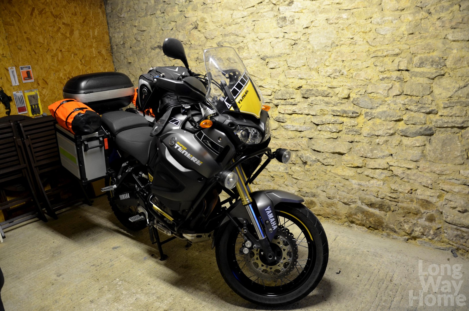
Fully packed and “overloaded” motorcycle
This is just a route to the ferry harbour, which we want to overcome as fast as possible, and we are already attracting a lot of interest at every stop. People come to us, talk, pat on a back and wish us a happy journey. When they do not have a chance to come up, they simply raise their thumb up. Probably our recognition has increased thanks to the bright orange bags on the side panniers. 😉
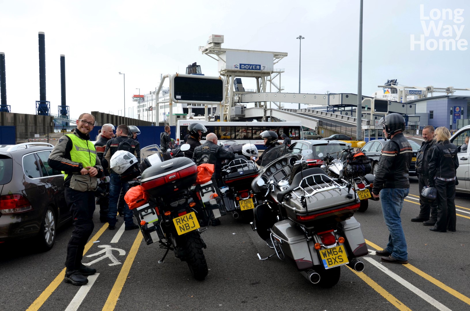
Awaiting the ferry to Calais
Along the way, nothing interesting happens, not counting runaway kilometres and chasing rain. The first night we spend in the north of Germany after covering almost 1000 km. We arrive late on a random campsite, and closed barrier does not surprise us at all. We call the number showed on the notice board and we are surprised to discover that not every German knows English. And we do not know any words (except “kaput”) in German. Unfortunately, we do not manage to understand each other. Thus we contact aunt Basia living in Germany, who arranges a place at a nearby campsite. We put a tent up and try to dry the soaked clothes.
And we already have the first conclusion from the first day: it is worth to learn a few basic phrases in the language of the country we are going to visit. 😉
Day 2. 13/06
The weather is not improving at all, everything is soaked. In addition, rain poured into the vestibule on the tarpaulin and flooded some of the clothes and shoes. Whoa, the plan to get completely wet was in Iceland, not before! Only 100 km before Hirtshals the sun begins to nicely warm us up. We use the opportunity and hang the motorcycle with wet clothes so we look like a Christmas tree. They dry at an express speed.
We arrive at the spot near 9:00 pm and the rest of the group one hour later. Some still try to upgrade the heating clothes system for cold Iceland or exchange the broken passenger footrest for a new one. Before we go to sleep, we admire the sunset on a beautiful beach nearby. We are impressed that it is still bright at midnight. The white polar night is just going to be a phenomenon!
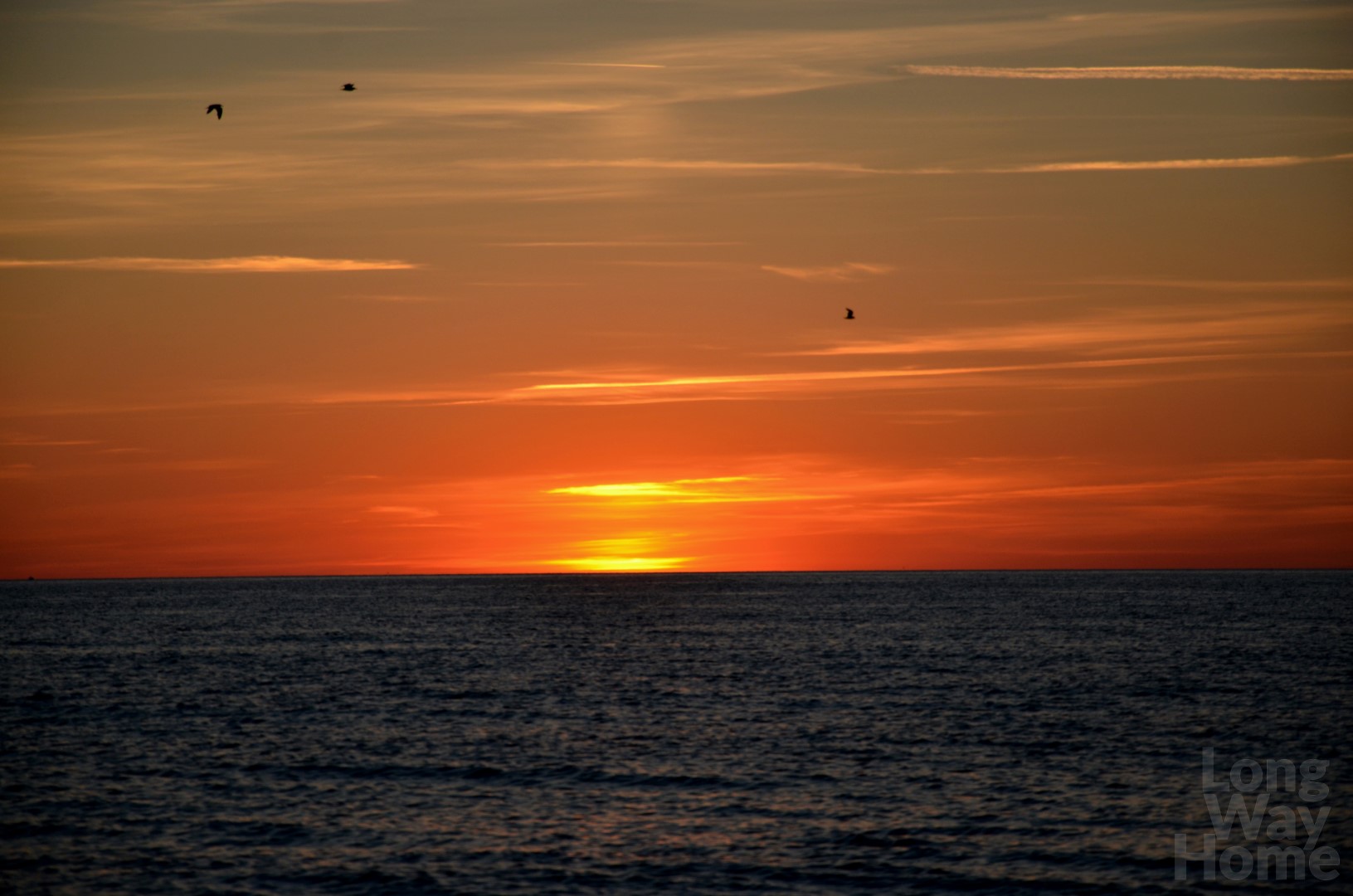
Sunset in Hirtshals
Day 3. 14/06
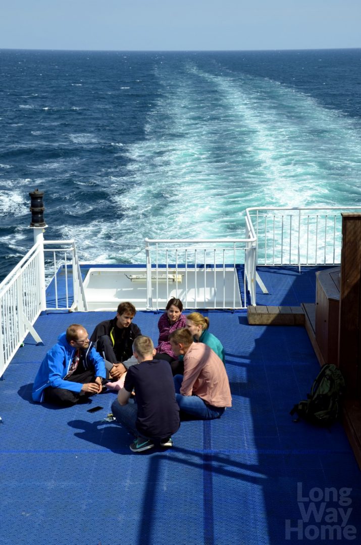
Time to get on a ship and drift away! We start in the morning, two and a half days on the ferry awaits us. All motorbikes park in front of the deck… except for our threes and a few others that no longer fit there. We lock motorcycles on the other side, which will be a big failure when leaving the ferry.
Our accommodation is… under the car deck! I do not recommend it to people with claustrophobia. They remind us of train couchette but without windows, with swinging entrance doors as in a Wild West bar. Height between the beds does not allow even the small person sitting below to straighten up completely. The cabins are divided into men’s and women’s. We managed to book one room for the whole team, so we are happy that we are together. Outside of the cabins, apart from standard amenities such as toilets with showers and a restaurant, there is also a cinema, swimming pool, sauna, gym, and a games room with consoles. There is no chance to get bored and such a ferry crossing can pass at an express speed!
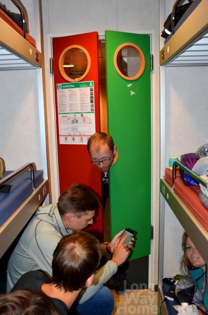
The cabin for nine people
The wind blows strongly. Even so, it is worth going to the outer deck on the eighth floor to refresh yourself and get some vitamin D from the sun. We are all in a good shape, though boat pitches from side to side.
We meet Norbert who has been living in Reykjavik for fourteen years. Listening to his stories about life in Iceland, the habits and traditions of native residents, we do not even notice how time flies. Norbert works as a bus driver, so he can recommend places worth seeing and also encourages us to move to Iceland. A tempting offer… 😉 It is worth meeting such a person – he gives us a lot of knowledge and stories, which we will not find in the guidebook.
The team with Norbert on the ferry
Day 4. 15/06
We still sail. Time slows down. We spend it polishing planned route, configuring intercoms between each other helmets, playing games that require more or less thinking. Around 5 PM we moor to the Faroe Islands, where the ferry has a half an hour break for reloading. Thorshavn harbour is filled with colourful houses with grass growing on the roof. Boats and ships calmly float on the gentle waves waiting for their turn to sail away.
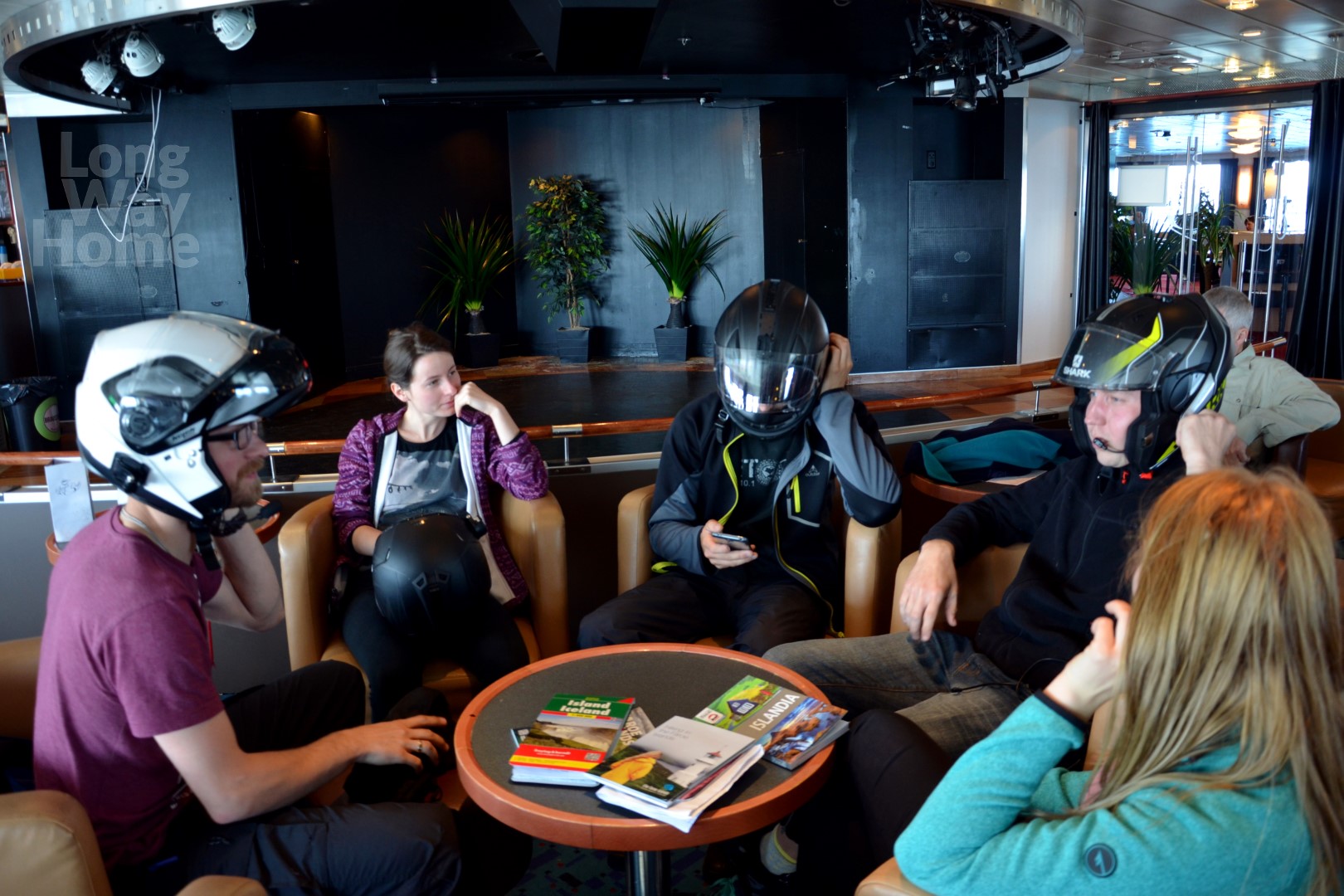
Configuring intercoms in a bar on the ferry
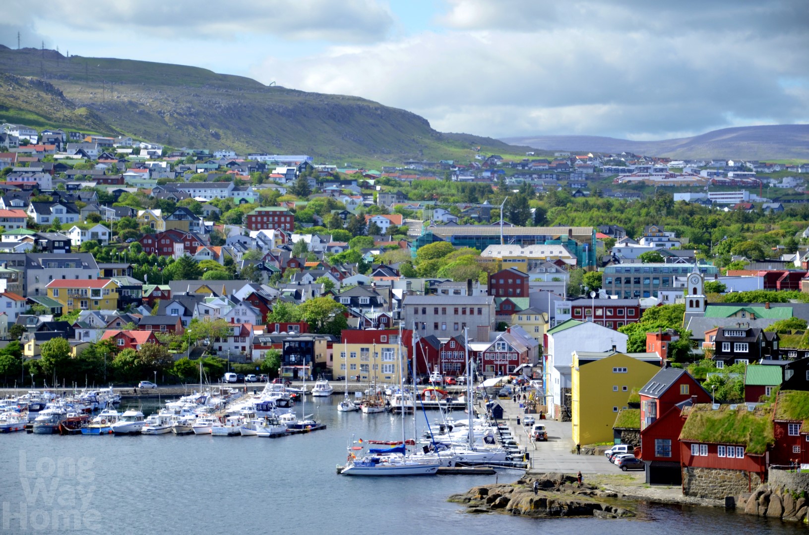
Thorshavn – the harbour and capital of Faroe Island
Day 5. 16/06
At last, there is 8 AM, which means that we will soon get off the ferry!! Everyone was asked by the crew to leave their cabins an hour before we get to the harbour. Now, they are gathering close to the stairs and lifts to have a chance of quick getting down to their vehicles. We cannot wait to get off, we want to finally feel the solid ground under our feet… But whoa! Not so fast! It turns out that the camper vans which supposed to leave first, are too high and would hit the ramp with their roof. On this ramp, other cars are parked! Well, nothing is lost (except for our time). Ferry crew puts the plan B into action: all cars must turn back, go around the deck and then leave. We can follow them at the very end! Motorcycles parked in the front of a ferry have been on the road for a long time. We are losing a few additional hours until we can finally leave the ferry and see the beauty of the wild and unpredictable Iceland.
The first views are breathtaking. We follow switchbacks snaking between the snow-capped peaks of the mountains. Fortunately for our bikes, the road is kept out of the snow. First, we climb to the top, to, just 20 km further, go down again to the nearest village which is situated at a sea level. Exhaled water vapour from the mouth only confirms the cold reflecting off the shady slopes and penetrating to the bone through our clothes. It’s good that we have prepared for such a circumstance by wearing at least a few (some of us maybe even a dozen or so) layers of clothes and gloves.
In Egilsstaðir, we refill food supplies and tap water, which is potable on the whole island. After a while, we continue on the main road towards the south-west. If we want to reach the first planned point, the Jökulsárlón glacier lagoon, we have to cover 230 km. We are surprised by the variability of the landscape on the route leading by mountains and valleys, sometimes on a tarmac and sometimes on a gravel. Gravel roads at a 14% slope down and 180-degree turns is not that easy for motorcyclists. Even Wojtek – more experienced rider – seems to be very focused and somewhat stressed due to a new challenge. As evidence of it, his anxious voice saying: “it is interesting…” can be heard in our helmets. In addition, sudden and strong windblasts increase our pressure. We have to react quickly and control the motorcycle’s moves. Fortunately, none of us is pushed off the road. An Englishman, Dave, whom we meet later, tells us the story of how the wind pushed him on the opposite side of the road while he travelled on his BMW GS… He was lucky, there was no oncoming car…
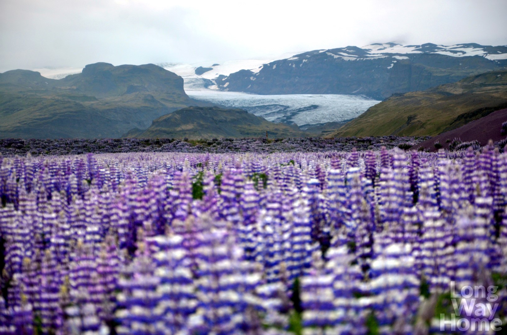
We are extremely impressed when Jökulsárlón finally appears before our eyes. The glacial lake measuring 248 meters in depth (the deepest on Iceland) is filled with huge floating ice blocks. These are remains of the Breiðamerkurjökull glacier retreating from the coast of the Atlantic Ocean. The glacier is seen in the background. The landscape often transforms. Sometimes the giant ice floes fill the lake completely, what allows some brave to “walk” on them. Another time, also during our trip, giant lumps float lazily in long distances from each other. On the other side of the road, we notice a “diamond beach” on which pushed by wind and waves, ice blocks melt and reflect the sun. We do not come across many blocks, but sometimes the beach can be seen as full of diamonds. Instead, we are lucky to see a seal splashing in the water!
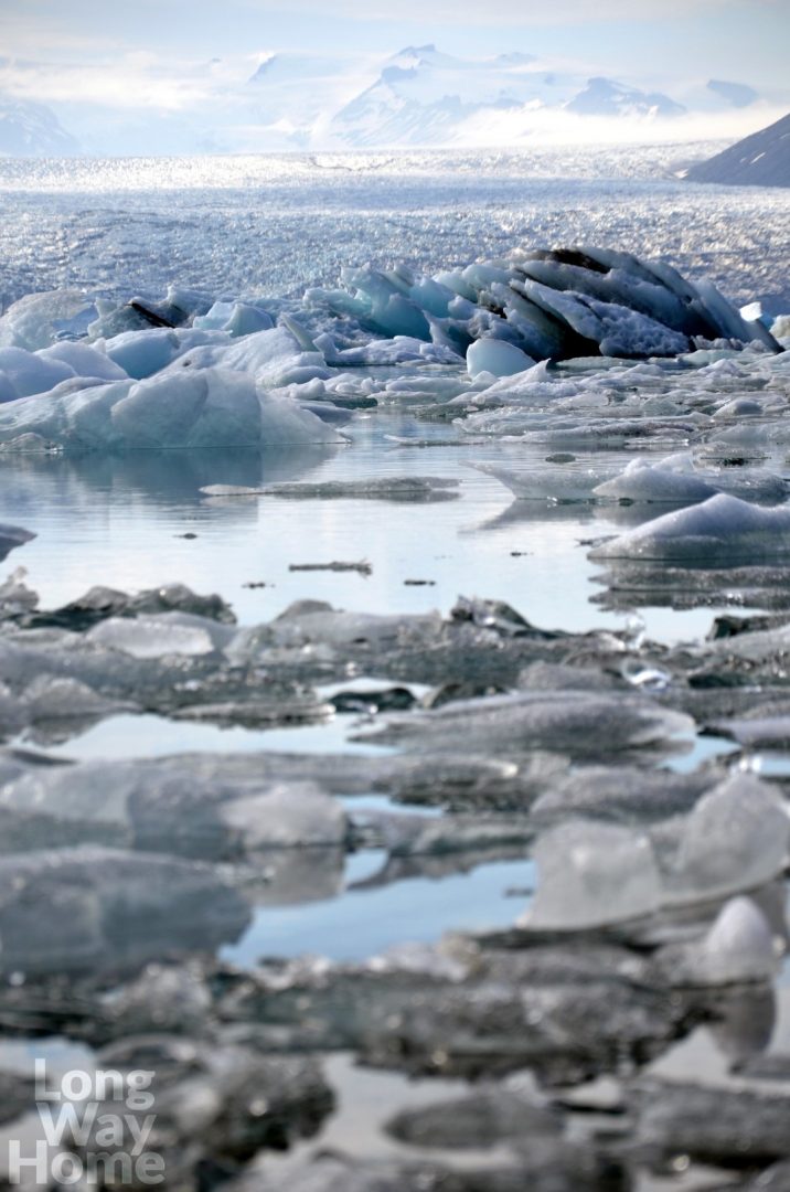
Ice blocks floating from Jökulsárlón glacier
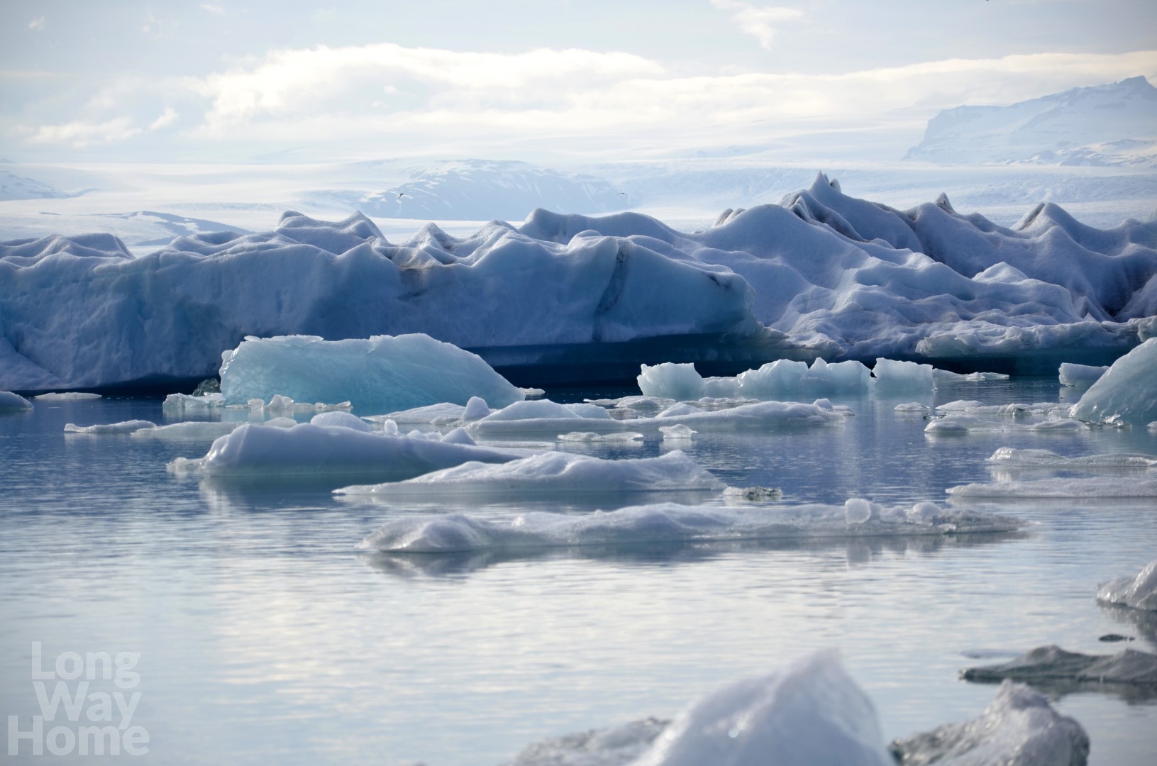
Glacial lake Jökulsárlón
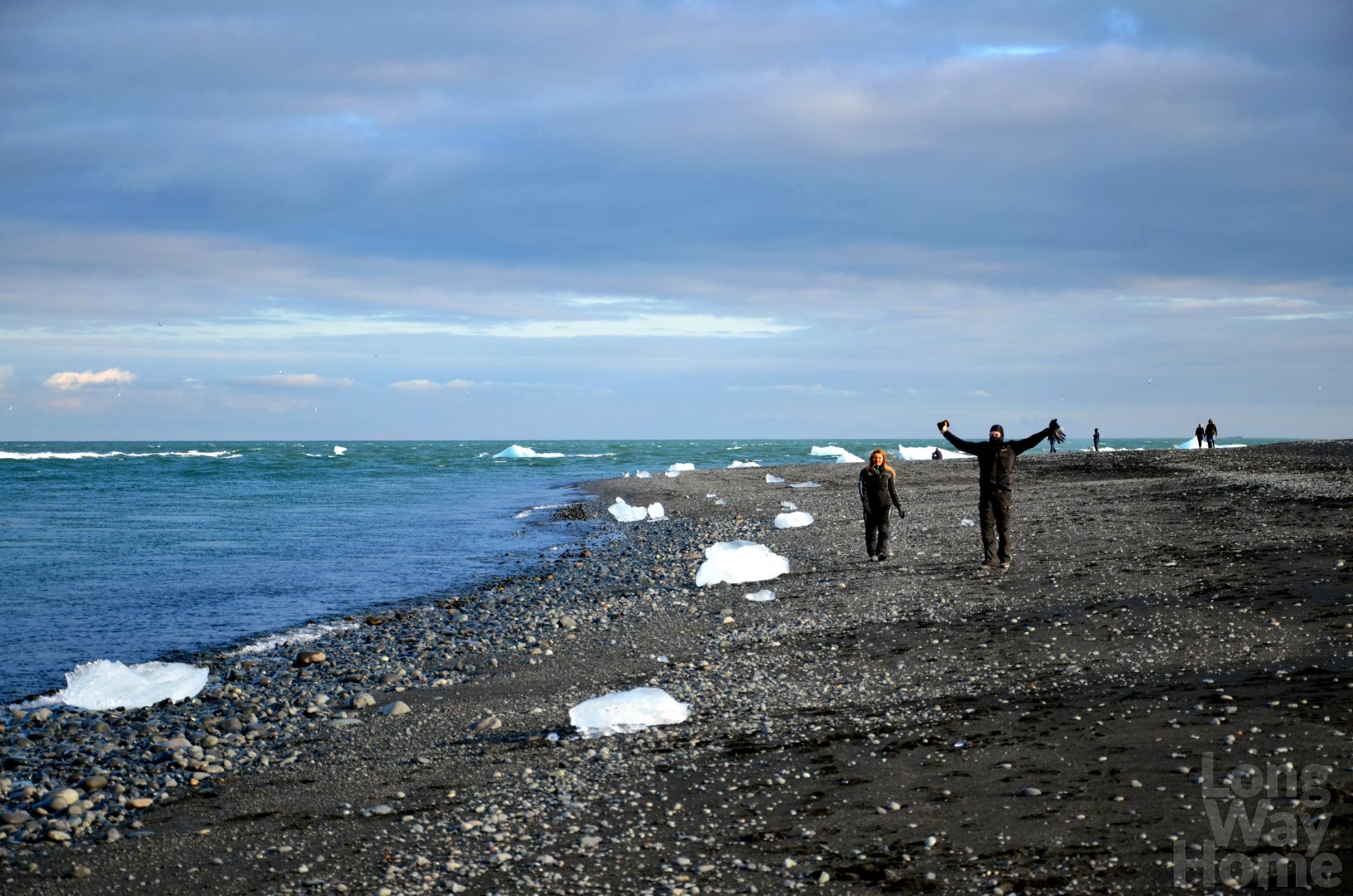
Diamond beach
A bit further we stop at the huge Svinafellsjökull glacier which you can climb for hours with the right equipment. I feel so tiny looking at it…
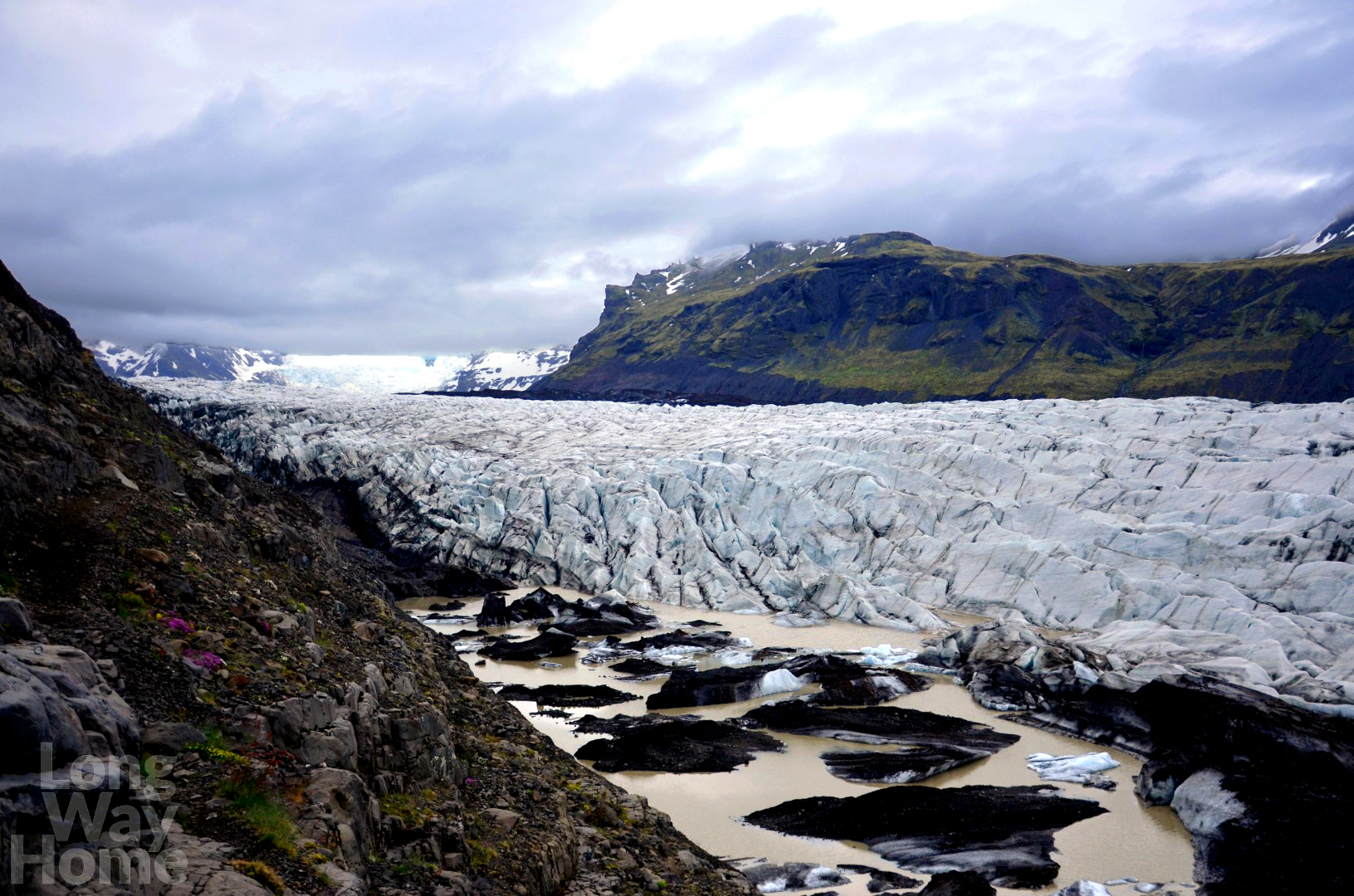
Svinafellsjökull glacier
Nearby, there is Hofskirkja – a small church covered with grass and a cemetery. It is one of the six and the last old church built of peat in the Icelandic style. Saint Clementine is its patron.
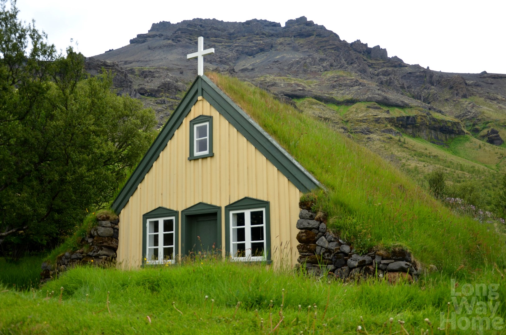
Hofskirkja church
Next, we head for the Svartifoss waterfall (black waterfall), whose water flows along basalt columns resembling organs. A twenty-minute walking trail leads from the parking to the waterfall. Despite its huge popularity, we do not meet almost anyone on the path. After some time, we realize that is because it is already late evening! We still have to look for a place to set up tents, prepare a meal…
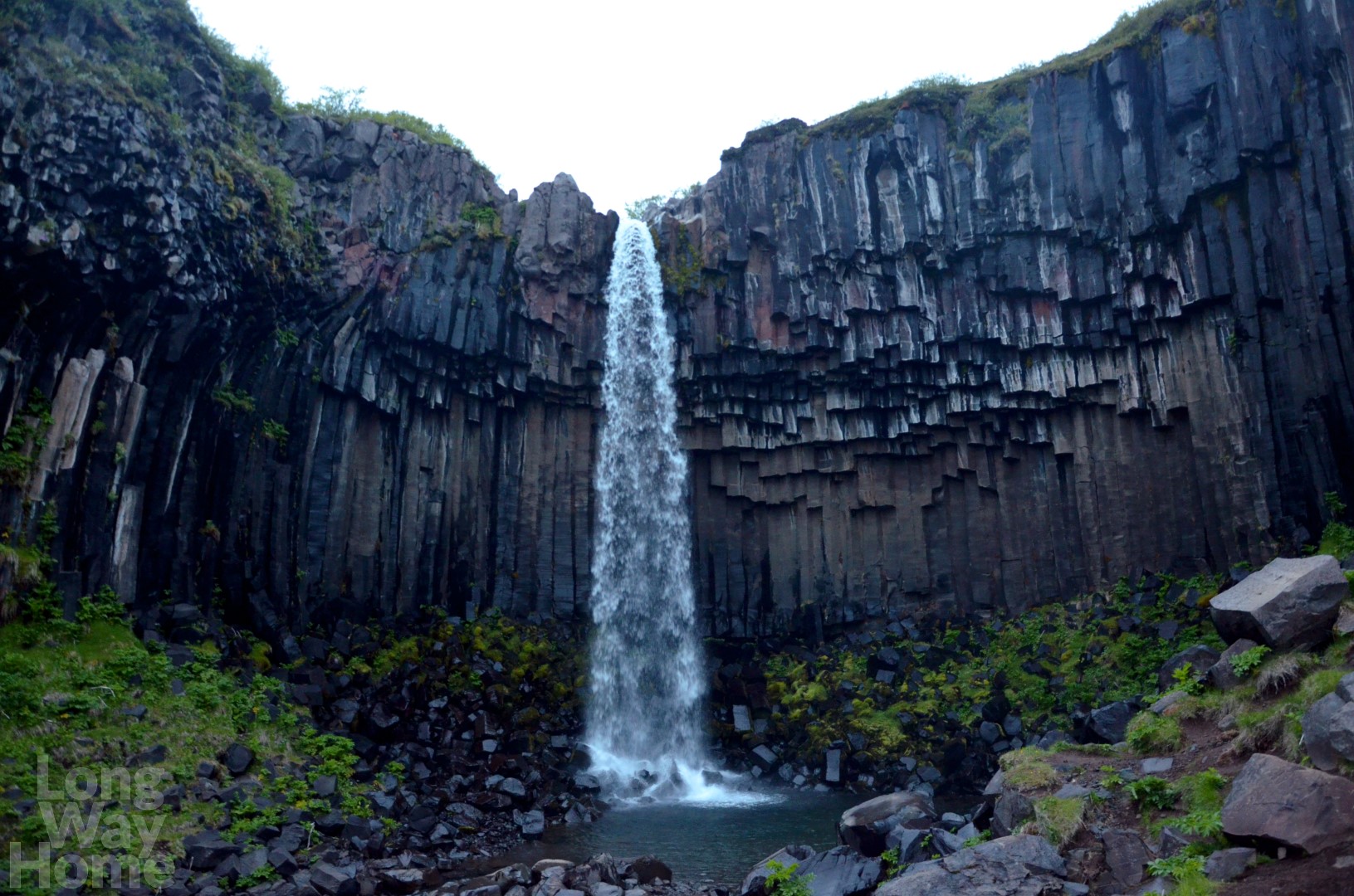
Black waterfall
Lack of twilight and darkness at night muddles in our heads. It deprives the consciousness of the passage of time. Only exhaustion gives signs that it is time to find a place to have a rest and relax. We are so tired that we decide to stay on a nearby campsite, which turns out to be the most expensive and the least equipped in all of Iceland, despite being located in the Vatnajökull National Park.
Day 6. 17/06 (Icelandic Independence Day)
The plan of wake-up around 9 AM (after seven hours of sleep) fails because the campsite owner, who wants to settle payment for the night, awakes us at 7 AM. We do not manage to fall asleep again, but in the end “we are here not for pleasure”. 😉 Most of the planned attractions for today is located next to the main road, so there is a chance we will see a lot.
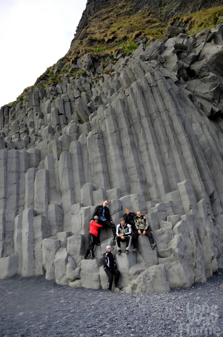
We start at Dvergharmar – a few hills with basalt pillars. We expected larger sizes of mountains. Not giving up too much time for them and neighbouring waterfall Foss a Sid, we head further towards the Fjaðrárgljúfur canyon. It stretches for 2 kilometres, is 100 meters of depth and the Fjaðra River flows in its middle. In order to reach it, we come off the main road on to a gravelly winding path. And it is more interesting! A good opportunity to make videos stops us in this place for longer. The canyon is beautiful! It does not seem to be huge, but I am entranced by its delicate and subdued colours. Facing the canyon, behind us a view stretches on the Skaftárhraun field which is covered with fluffy sponges. It is a frozen lava of Laki volcano overgrown with moss. Laki’s eruption in 1784 lasted for 8 months. Lava flooded the area of 580 km2 causing starvation of 25% of Iceland’s population. Average air temperature in the northern hemisphere has dropped by 1 ° C, causing the most severe winter in four hundred years.
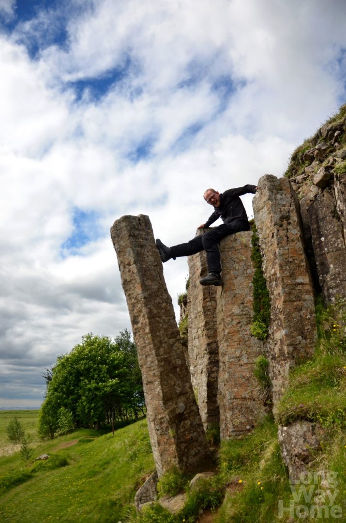
Łukasz on Dvergharmar
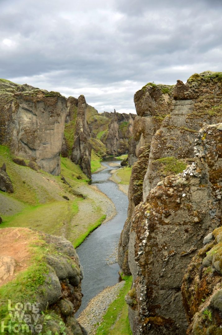
Fjaðrárgljúfur canyon
We also stop at Kirkjugólf. From Icelandic, this word means the floor of the church and is a rock formation that looks like honeycombs.
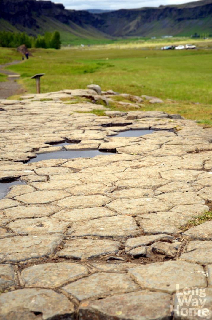
Kirkjugólf
Then we head towards Vík í Mýrdal (bay of the swampy valley) passing along deserted terrains devastated by a huge flood. Guides do not encourage us to stay longer in this area, stating that there is nothing worth seeing. However, I am fascinated by the awareness of how nature or one event over a long period of time can shape the area for many hundreds of years. Scattered stones lie around us, which has been brought by water from the distant mountains.
In the village, we allow ourselves a longer break, because the weather is in our favour. Nobody would say that this place has the highest annual rainfall (2275mm/year). After refuelling, we order the recommended by Norbert and apparently the best hamburger on the whole island – Syslumann. It really tastes delicious. Apart from lamb, which is used here for all dishes, the hamburger also has a fried egg, bacon. It is all served with chips and a salad of grilled vegetables. Goody! In addition, we sample the national soup Kjötsúpa, which is made of a lamb (of course!) and vegetables, mainly cabbage. In addition to the distinctive and characteristic meat taste, the soup reminds us Polish cabbage soup.
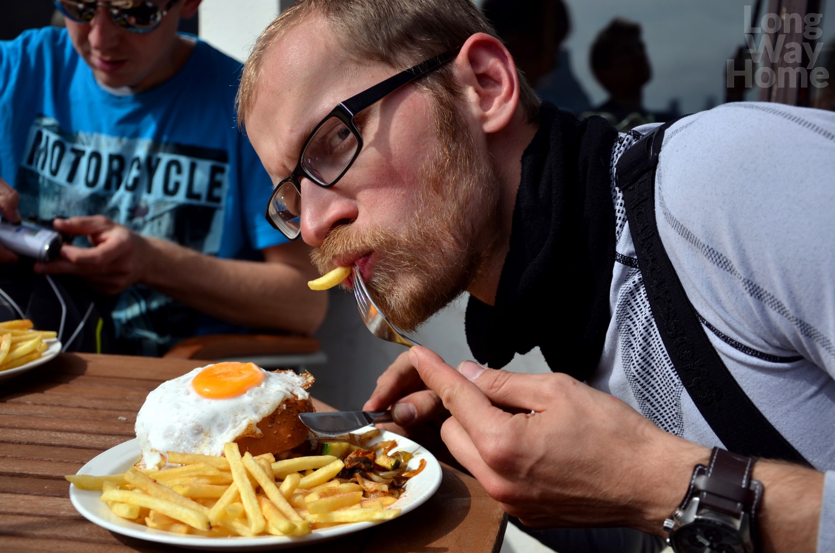
The most delicious and the most expensive hamburger in Iceland
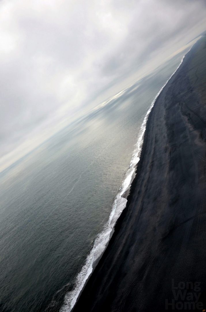
After the break, which makes us really lazy, we go to one of the most beautiful beaches with black sand and gravel. The scenic cliffs, the Hálsanefshellir cave and the Garðar basalt rock formations with columns reminding huge organs add charm to it. No, we are not here to swim and sunbathe – the full sun does not mean heat. 😉 Reynisfjara beach can be dangerous due to rapid tides and high waves capturing people into its depths. Fortunately for us, we get here at a peaceful time.
Garðar on the Reynisfjara beach
We ride up a cliff on the other side of the beach, from where we can see a group of white birds drifting on waves to the contrasting black land. After shaking off water from their feathers, they join the others.
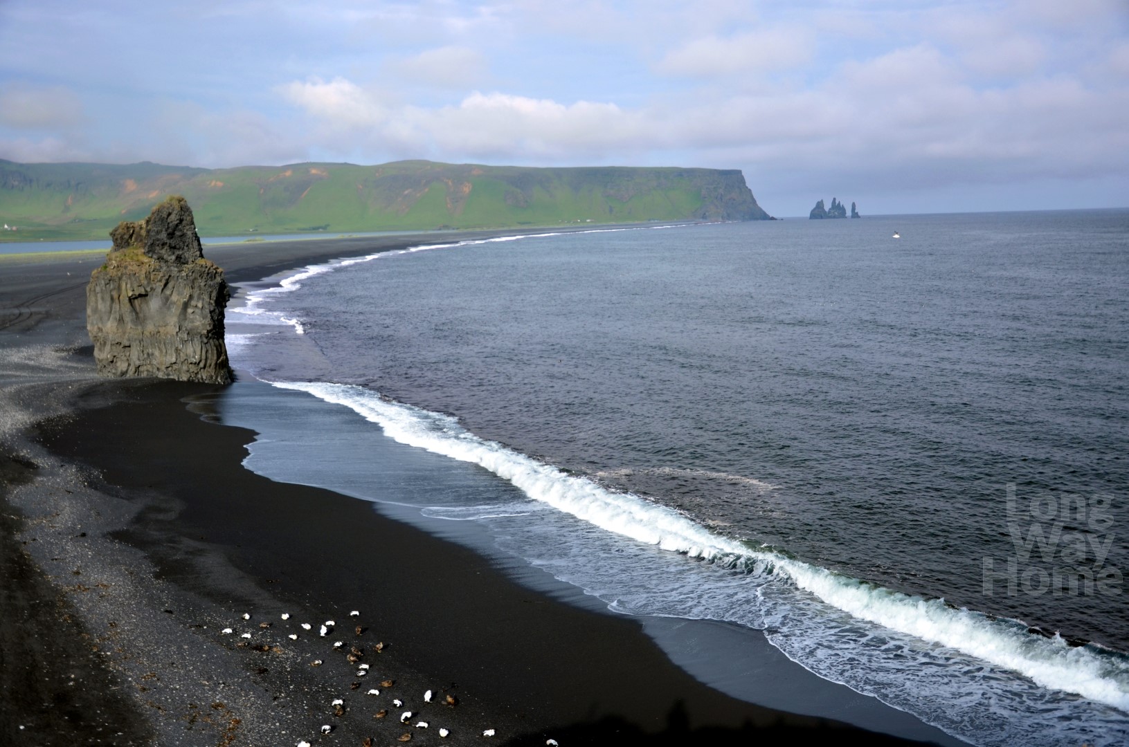
Reynisfjara beach
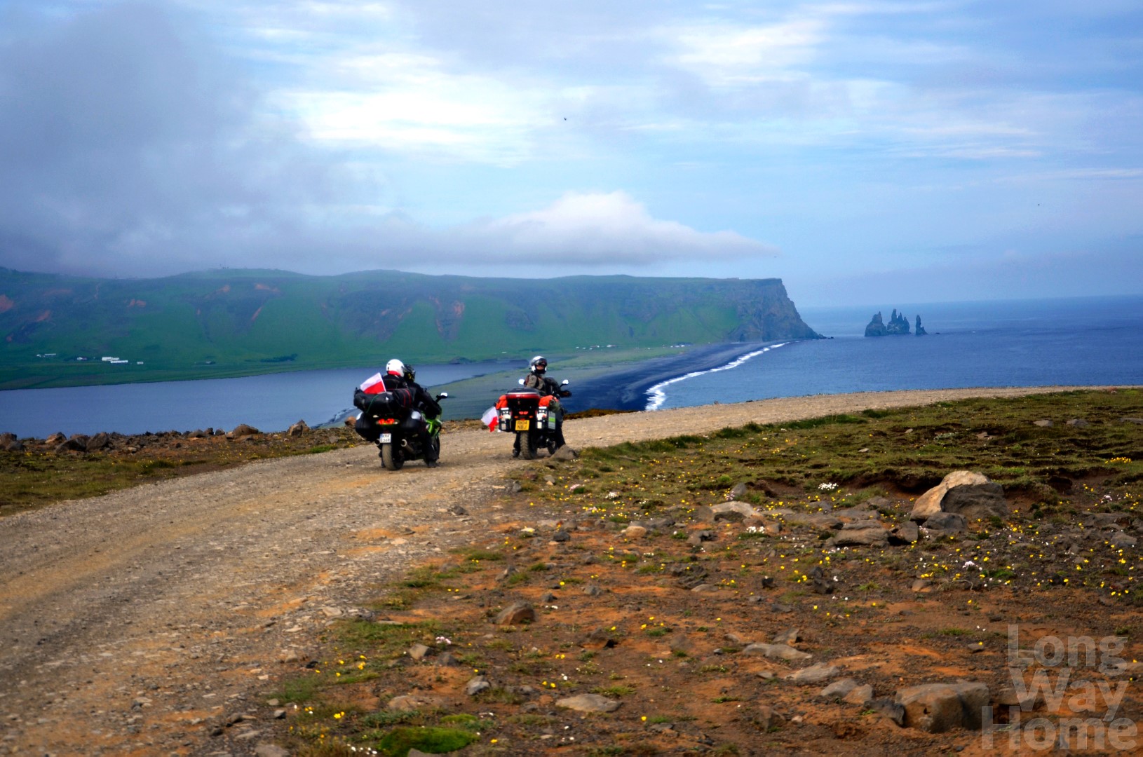
Then we slowly try to get to the Dyrhólaey Plateau – a bird sanctuary, including puffins. The road is not easy. It is covered with loose gravel and large stones, has ruts and sharp bends. In addition, it goes steeply uphill. We lose the traction on the potholes and almost crash motorcycle to a side. Łukasz manages to support bike with his leg, I slide down on his seat and join in to try and keep it up. This way, holding the leaned Yamaha, we wait for Wojtek and Ewa, who come to the rescue and all together we bring the motorcycle back to its correct position. Phew, it was interesting for me, but I can only guess that was less for Łukasz.
At the top, it turns out that the longed-for Puffins are gone. Even on the sign informing which species of birds can be found, there is an image of a puffin crossed by an anonymous tourist. Some of us are disappointed. Despite it, it is worth taking the route for the beautiful views of the spectacular black beach of Reynisfjara. Apart from it, the Toin rock arch surfaces out of the ocean. Oh, and the route itself is exciting! The way back down flows smoothly, but with some adrenaline.
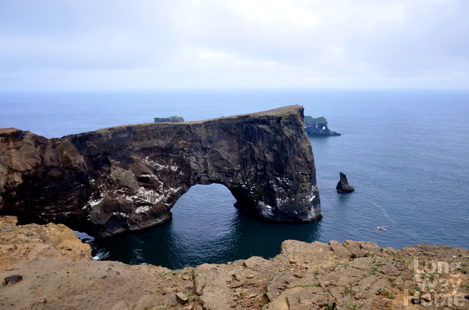
Toin rock arch
Black-sanded beach
The way back down from Dyrhólaey plateau
Going further we pass the wreck of an American Dakota military aircraft, which crashed in 1973. In the past, you could ride up to it, now you have to leave the vehicle four kilometres from it and then approach. Due to the late time, we give it up. Soon we will have to look for a place to sleep.
We reach the waterfall Skógafoss (forest waterfall) which is 62 meters high and 25 meters wide. A double rainbow appears in fine weather, unfortunately, we are not lucky to see it. However, the waterfall makes an impression both from the bottom and from the upper platform. The legend says that the first settler in these lands hid the treasure behind Skógafoss but nobody has found it yet. Łukasz plans to start the search and jump into the water with trunks. Who knows if he would find a treasure? However, the temperature of the water would probably deter anyone.
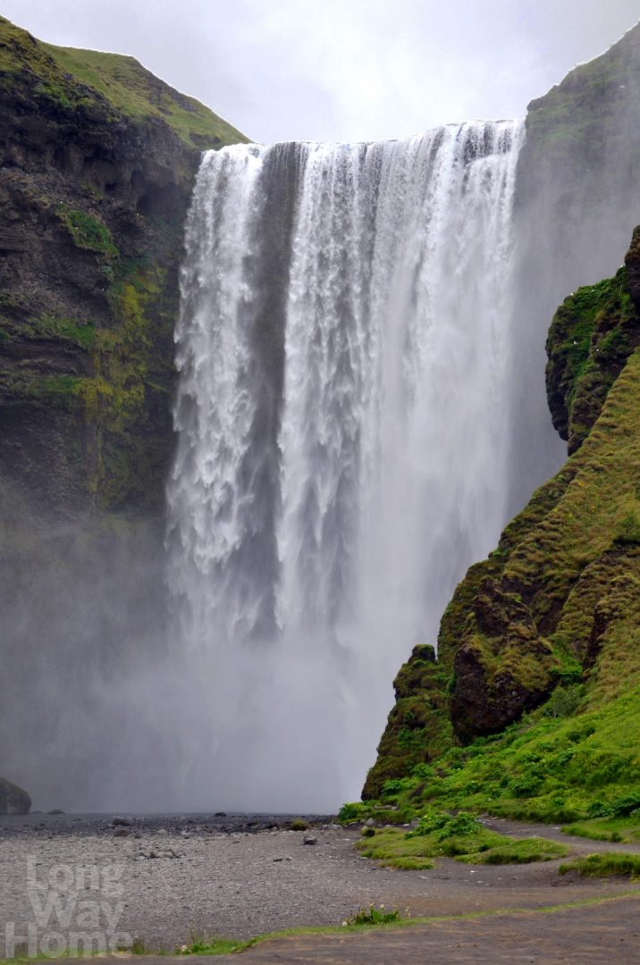
Forest waterfall
The lack of sunset again misleads us and it is very late! We find rest in the wild in a beautiful place. Surrounded by blooming purple-white lupines, we fall asleep around 1 AM. Before we go to sleep, I capture the cloudy front instantly approaching from the ocean. Swirly clouds look as they are racing to the nearest obstacle, a mighty mountain inland. I have never experienced such an expressive and turbulent phenomenon before.
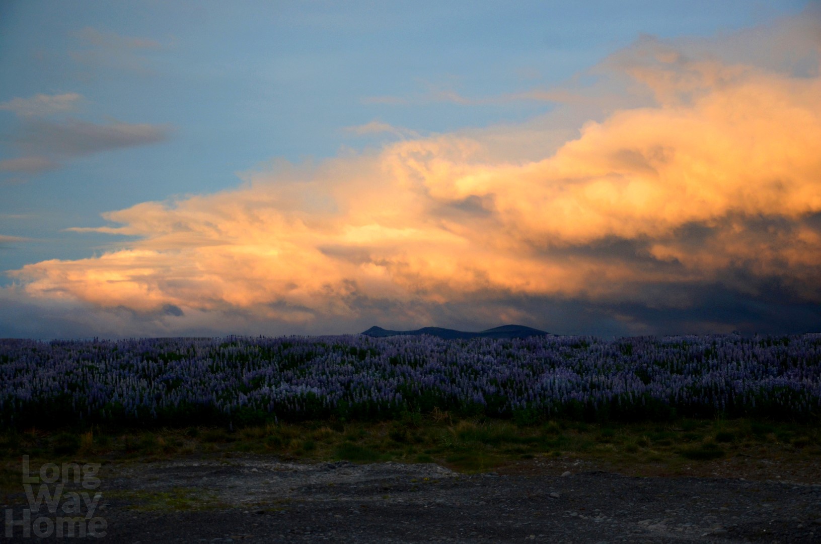
Approaching front from the ocean
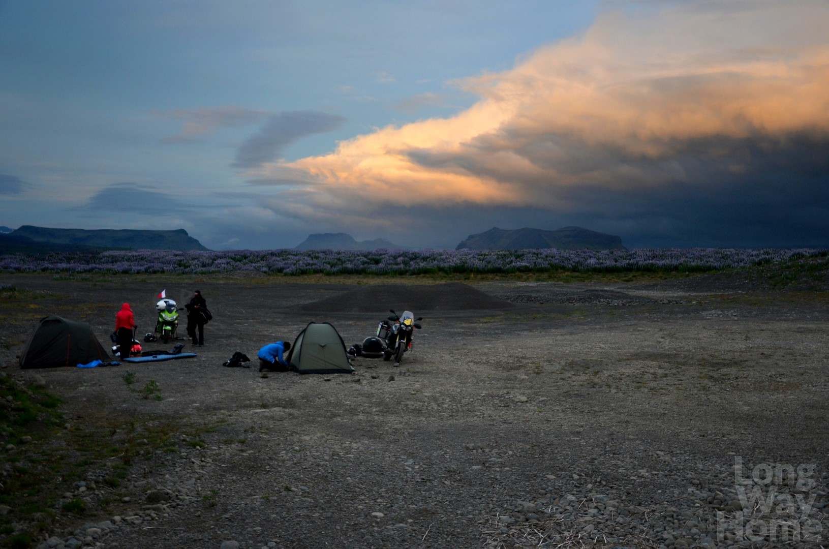
Setting up camp
Overnighting in the wild among Lupines
Day 7. 18/06
The morning begins with another waterfall Seljalandsfoss, which can be walked around. Long ago there was the coastline of the ocean in this place. At the sunset, the sun is in front of the waterfall and the freely falling water takes the golden-yellow colour. It has to be a beautiful view. We miss it because the time of day is completely different. Anyway, at this time of year, we would not have seen that moment at all. 😉
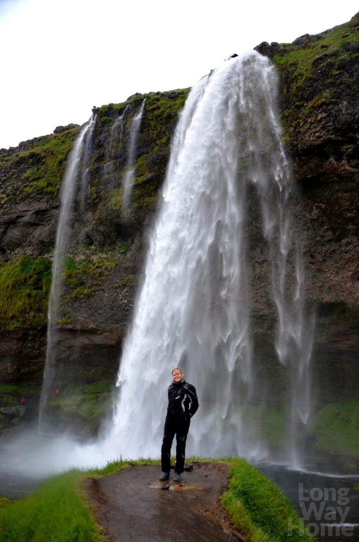
Seljalandsfoss waterfall
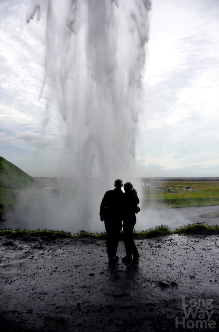
Seljalandsfoss from the other side
Going further along the island main ring road we pass the Pétrusey mountain (Island of Peter). In the 13th century, during the threat of the Norwegians invasion, two hundred men were placed there to prevent an attack from the ocean. In more distant times the Elves used to live in it. It is worth mentioning that 80% of islanders believe in the existence of Elves. Their dwellings are taken into account when building roads. For this reason, the planned road at the north of Iceland has not been built so far. A lady, a negotiator between people and Elves, cannot get the agreement. The Elves still refuse to build a road around their habitat. Well, I hope that the negotiations will end sometime.
Today we want to reach Landmannalaugar (Colorful mountains), where we plan to spend the night, go trekking on the next day and in the late afternoon head further. However, the increasingly strong rain crosses our plans. In addition, we find out that our mountain route is impassable today.
Well, we choose a different direction and way to rest: swimming in a hot river near Hveragerði. When we reach the supposed place, we are surprised that there is no one. Something does not suit me, but I am trying to explain that in such a torrent nobody wants to go to the mountains to undress and jump into the water. Even better – the river will only be ours! After losing a lot of time devoted to clothes change (which is not an easy task during rain), loading up motorcycles with unnecessary things, locking them, covering, it turns out that… we are in the wrong place! We have enough! Raged, we reorganize quickly, we go where we should, park and finally we can go! An ideal place for bathing is located three kilometres further in the mountains, where the very hot stream flows into the cold one and their temperatures mix up to a pleasant one. This feeling when you bask in a nice warm river, while it is cold and wet, is unbelievably relaxing! Ewa and Ewelina are crazy as they decide to take a short bath in the almost boiling river above the creek! However, after a while, they change their mind and with reddish legs, join us. Getting out of the river is not that comfortable anymore, especially when you have to put on dirty and thick motorcycle clothes.
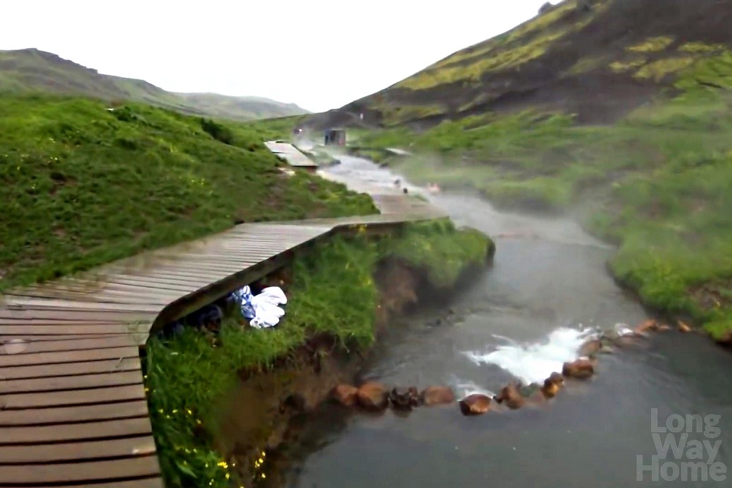
Hot river
It’s getting late and we have to take care of a place to sleep again. The rest of the team sleeps at the campsite in Hveragerði. Łukasz finds a great place for us behind the hill that protects us from the wind and people on the path. When the tent is set up, the sleeping bags are unfolded, the mats inflated, and we are ready to sleep, we meet the guards in the car park. They look for people who overnight illegally inside the city and refer to nearby campsites. They do not notice our tent, but they imply that they patrol the place every hour. A parked motorcycle would be a sign for them to look for owners in the area. Because we have nowhere to hide the motorcycle, frustrated and irritated we pack all the equipment and after some time we join the rest of the team to set up again and finally go to sleep. It was a long, demanding and exhausting day.
Although we are still in the south of Iceland, we have seen more than half of what we wanted. Tomorrow we head to circle in the interior of Iceland and we move further to the north of the island. We will get back this way to the harbour where the ferry will await us.